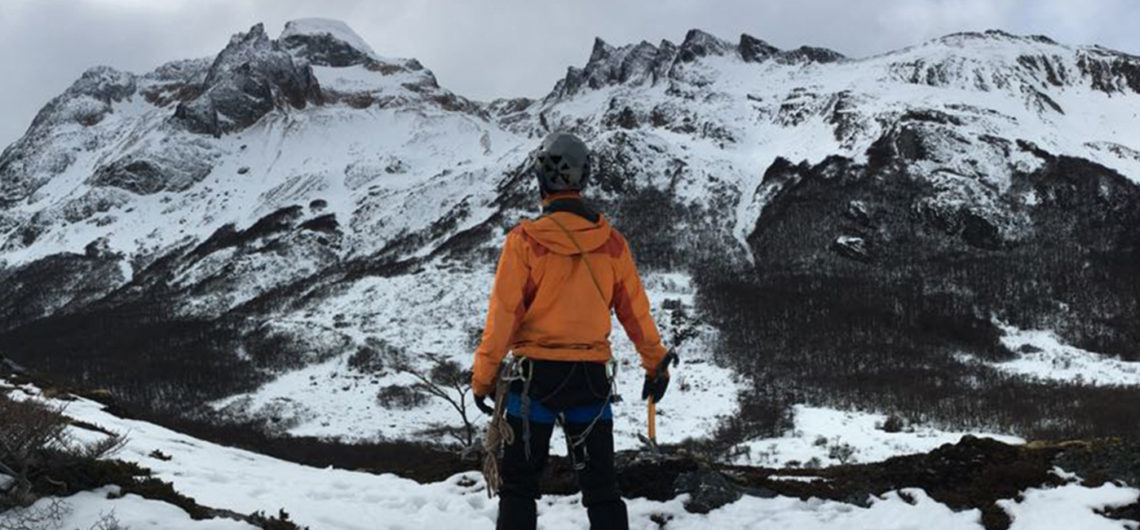
<b>Before embarking on an adventure itinerary, it is important that you always know its level of difficulty</b><span style="font-weight: 400;">. </span> <span style="font-weight: 400;">For this, in the mountain and adventure tours, </span><b>we use grading systems that allow you to obtain information in advance about the difficulty of each route</b><span style="font-weight: 400;">.</span> <span style="font-weight: 400;">In this article of our blog <strong><a href="https://www.huka.com.ar/en/blog/">Blog</a></strong>, </span><b>we want you to know the way we measure the degree of difficulty of the routes of mountain and adventure Huka</b><span style="font-weight: 400;">, so you always know the level of preparation you will need and the requirement to which you will be exposed.</span> <span style="font-weight: 400;">To this grading system, </span><b>you can also add a plus sign (+)</b> where the difficulties slightly exceed the characteristics described here<span style="font-weight: 400;">.</span>
<h3><b>BEGINNER</b></h3>
<b>Relaxed (1)</b><span style="font-weight: 400;">
</span><span style="font-weight: 400;">Enjoy an adventure, clear your mind and connect with nature at your own pace.</span>
<ul>
<li style="font-weight: 400;" aria-level="1"><span style="font-weight: 400;">Activity: 1-3 hours, most days.</span></li>
<li style="font-weight: 400;" aria-level="1"><span style="font-weight: 400;">Distances: less than 5 km, most of the time.</span></li>
<li style="font-weight: 400;" aria-level="1"><span style="font-weight: 400;">Surfaces: flat terrain.</span></li>
<li style="font-weight: 400;" aria-level="1"><span style="font-weight: 400;">Elevation change: little or none.</span></li>
</ul>
<b>Easy (2)</b><span style="font-weight: 400;">
</span><span style="font-weight: 400;">Ideal for newcomers to more active travel.</span>
<ul>
<li style="font-weight: 400;" aria-level="1"><span style="font-weight: 400;">Activity: 3-5 hours, most days.</span></li>
<li style="font-weight: 400;" aria-level="1"><span style="font-weight: 400;">Distances: walking up to 10 km most of the time.</span></li>
<li style="font-weight: 400;" aria-level="1"><span style="font-weight: 400;">Surfaces: uneven terrain, with some steep climbs and descents.</span></li>
<li style="font-weight: 400;" aria-level="1"><span style="font-weight: 400;">Elevation change: up to 600 meters per day.</span></li>
</ul>
<h3><b>INTERMEDIATE </b></h3>
<b>Moderate (3)</b><span style="font-weight: 400;">
</span><span style="font-weight: 400;">For those who are taking their first steps or want to continue adding experience in nature.</span>
<ul>
<li style="font-weight: 400;" aria-level="1"><span style="font-weight: 400;">Activity: 5-8 hours, at least, some of the days.</span></li>
<li style="font-weight: 400;" aria-level="1"><span style="font-weight: 400;">Distances: walking up to 16 km, most days.</span></li>
<li style="font-weight: 400;" aria-level="1"><span style="font-weight: 400;">Surfaces: undulating or hilly terrain with some steep climbs / descents and uneven trails.</span></li>
<li style="font-weight: 400;" aria-level="1"><span style="font-weight: 400;">Elevation change: up to 1000 meters per day.</span></li>
</ul>
<b>Demanding (4)</b><span style="font-weight: 400;">
</span><span style="font-weight: 400;">Recommended for people engaged in physical activity with basic activity skills.</span>
<ul>
<li style="font-weight: 400;" aria-level="1"><span style="font-weight: 400;">Activity: 8-10 hours, at least, some of the days.</span></li>
<li style="font-weight: 400;" aria-level="1"><span style="font-weight: 400;">Distances: up to 20 km most days.</span></li>
<li style="font-weight: 400;" aria-level="1"><span style="font-weight: 400;">Surfaces: Mountainous and exposed terrain with steep ascents and descents and uneven trails.</span></li>
<li style="font-weight: 400;" aria-level="1"><span style="font-weight: 400;">Elevation change: up to 1200 meters per day.</span></li>
<li style="font-weight: 400;" aria-level="1"><span style="font-weight: 400;">Altitude: up to 4500 meters. Altitude experience may be required. </span></li>
</ul>
<h3><b>ADVANCED</b></h3>
<b>Difficult (5)</b>
<span style="font-weight: 400;">Designed for trained and experienced people in the field.</span>
<ul>
<li style="font-weight: 400;" aria-level="1"><span style="font-weight: 400;">Activity: more than 10 hours, at least, some of the days.</span></li>
<li style="font-weight: 400;" aria-level="1"><span style="font-weight: 400;">Distances: 20 km or more most days.</span></li>
<li style="font-weight: 400;" aria-level="1"><span style="font-weight: 400;">Surfaces: remote, hilly and exposed terrain with steep ascents and descents, uneven trails with loose features.</span></li>
<li style="font-weight: 400;" aria-level="1"><span style="font-weight: 400;">Elevation change: up to 1200 meters per day.</span></li>
<li style="font-weight: 400;" aria-level="1"><span style="font-weight: 400;">Altitude: can exceed 4500 meters. Altitude experience is required. </span></li>
</ul>
Before embarking on an adventure itinerary, it is important that you always know its level of difficulty. For this, in the mountain and adventure tours, we use grading systems that allow you to obtain information in advance about the difficulty of each route.In this article of our blog Blog, we want you to know the way we measure the degree of difficulty of the routes of mountain and adventure Huka, so you always know the level of preparation you will need and the requirement to which you will be exposed.To this grading system, you can also add a plus sign (+) where the difficulties slightly exceed the characteristics described here.
BEGINNER
Relaxed (1) Enjoy an adventure, clear your mind and connect with nature at your own pace.
Activity: 1-3 hours, most days.
Distances: less than 5 km, most of the time.
Surfaces: flat terrain.
Elevation change: little or none.
Easy (2) Ideal for newcomers to more active travel.
Activity: 3-5 hours, most days.
Distances: walking up to 10 km most of the time.
Surfaces: uneven terrain, with some steep climbs and descents.
Elevation change: up to 600 meters per day.
INTERMEDIATE
Moderate (3) For those who are taking their first steps or want to continue adding experience in nature.
Activity: 5-8 hours, at least, some of the days.
Distances: walking up to 16 km, most days.
Surfaces: undulating or hilly terrain with some steep climbs / descents and uneven trails.
Elevation change: up to 1000 meters per day.
Demanding (4) Recommended for people engaged in physical activity with basic activity skills.
Activity: 8-10 hours, at least, some of the days.
Distances: up to 20 km most days.
Surfaces: Mountainous and exposed terrain with steep ascents and descents and uneven trails.
Elevation change: up to 1200 meters per day.
Altitude: up to 4500 meters. Altitude experience may be required.
ADVANCED
Difficult (5)
Designed for trained and experienced people in the field.
Activity: more than 10 hours, at least, some of the days.
Distances: 20 km or more most days.
Surfaces: remote, hilly and exposed terrain with steep ascents and descents, uneven trails with loose features.
Elevation change: up to 1200 meters per day.
Altitude: can exceed 4500 meters. Altitude experience is required.
<strong>Introduction</strong>
<hr>
Arenales is one of the 3 world class climbing schools in Argentina, along with Chalten in Santa Cruz, and the Frey in Rio Negro (Bariloche). Located at about 2,500 meters above sea level in the Cordón Portillo of the front range of the Andes, it has an arid high altitude climate, scarce bush vegetation and an imposing landscape full of needles and granite walls, surrounded by hills that reach up to 5,500 meters above sea level.
<img class="wp-image-1615 alignleft" src="https://www.huka.com.ar/wp-content/uploads/2019/12/logo_fpl-300x300.jpg" alt="" width="138" height="138">
It is worth mentioning the work of the <a href="http://www.fundacionpiedralibre.org" target="_blank" rel="noopener noreferrer">Piedra Libre Foundation</a>, whose objective is to ensure free and open access to the Cajon de los Arenales.
<strong>Climate and season</strong>
<hr>
The high season generally begins in October and lasts until mid to late April. Being a mountainous region located at an altitude between 2,500 and 3,500 meters above sea level, <a href="https://www.windguru.cz/573540" target="_blank" rel="noopener noreferrer">weather conditions</a> can vary in any season.
<div class="page" title="Page 9">
<div class="layoutArea">
<div class="column">
<strong>Shelter and camping</strong>
<hr>
There is a shelter built and maintained by climbers located 20 minutes on foot from the entrance to the canyon. It has dry toilets, basic facilities to stay inside, cook and sleep, no electricity and no cell phone signal. The refuge is <em>free</em> to use and the maintenance of the facilities is the responsibility of all those who use it. There is no shelter or concessions.
[caption id="attachment_1616" align="aligncenter" width="536"]<img class="wp-image-1616" src="https://www.huka.com.ar/wp-content/uploads/2019/12/refugio_arenales-300x225.jpg" alt="" width="536" height="402"> <em>View of the refuge in Cajon de los Arenales</em>[/caption]
There are also several natural shelves in the area where it is possible to set up tents. It is also possible to camp in several sites in the vicinity of the Portinari Refuge and in the vicinity of the Arroyo del Cajón bridge, where vehicles are left. It is forbidden to camp on or near the mallín (sites with higher humidity, soils and tender grasses). El Cajón has a drinking water stream fed by the Arenales glacier. Water must be loaded in it before approaching the different needles, since there are no water courses at the foot of the needles.
</div>
</div>
</div>
<strong>Climbing properties</strong>
<hr>
[caption id="attachment_1629" align="alignleft" width="375"]<img class="wp-image-1629" src="https://www.huka.com.ar/wp-content/uploads/2019/12/campanille-242x300.jpg" alt="" width="375" height="465"> <em>Campanille Needle</em>[/caption]
The main activity in the canyon is classic climbing in adventure terrain, although there are some fully equipped mono and multi-pitch sport sectors. The area offers huge granite walls of hundreds of meters, with possibilities for <em>big wall</em> and artificial routes. The climbing is technical, with more than 300 open routes ranging from 4+ to 8a+ with lines of up to 500 meters, although on average they do not exceed 200 meters. In the last few years <em>bouldering</em> has proliferated, with more than 40 problems currently proposed. The area has an enormous potential and is in constant growth.
<div class="page" title="Page 10">
<div class="layoutArea">
<div class="column">
The approach to the different needles is complex in itself, taking several hours in some cases due to the steepness of the slopes, the amount of loose rock and the amount of hauling found in the terrain.
<div class="page" title="Page 10">
<div class="layoutArea">
<div class="column">
It is important to keep in mind that many of the formations do not form compact monoliths, so it is recommended to be careful and evaluate the quality of the rock very well.
</div>
</div>
</div>
When it comes to rappelling, the majority of the needles have a descent line composed of fixed anchor rappel installations.
</div>
<strong>Equipment required</strong>
</div>
</div>
<hr>
It is necessary to have good footwear for approaching, and to consider the climatic conditions of the area when choosing the appropriate clothing, since the thermal amplitude between day and night is usually wide, as well as the difference between climbing in the sun or in the shade. Regarding the specific climbing equipment, the use of double ropes for climbing on the needles can be considered ideal, depending on each line the specific amounts of protection equipment needed, as they are so diverse. This information can be found in the 2 recommended guides below.
<strong>Climbing guides</strong>
<hr>
You can find the complete guide by Mauricio Fernandez <em>Arenales - Guía de escalada, </em>available for free on the <a href="http://www.fundacionpiedralibre.org" target="_blank" rel="noopener noreferrer">website</a> of the foundation Piedra Libre, . There is also a very complete guide by Ignacio Elorza: <em>Arenales - Guia integral de escalada en roca, </em>which is available for sale in different mountain stores or on the internet.
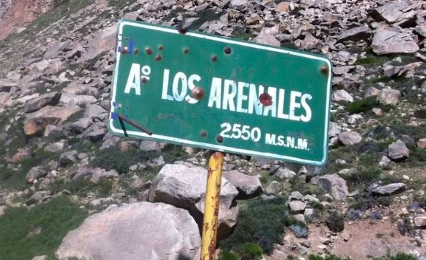
<strong>How to get there</strong>
<hr>
Arenales is located 135 km southeast of Mendoza in the town of Tunuyan. To get there by public transport there are regular bus services from Mendoza to Tunuyan, and from there you must take another bus to the Manzano Histórico. From the Manzano Histórico, if you do not have your own vehicle, you can hire a private transfer to complete the route that separates the Manzano from the drawer, walk or hitchhike. It is 12.5 km of gravel road to the Portinari Refuge belonging to the gendarmerie, where you must register to enter the area (they ask for an ID card or passport). After registering, you must continue on the gravel road (from this point in worse conditions), about 5 km more until the bridge that crosses the stream that descends from Cajon de los Arenales, where the vehicles are left and the path that enters the area begins. With the necessary precautions, it is possible to arrive in car although the advisable thing is a pickup truck, without necessity that it is 4x4.
<div class="mapouter">
<div class="gmap_canvas"><iframe id="gmap_canvas" src="https://maps.google.com/maps?q=Cristo%20Redentor%20paso%20Tunuy%C3%A1n&t=k&z=11&ie=UTF8&iwloc=&output=embed" width="700" height="400" frameborder="0" marginwidth="0" marginheight="0" scrolling="no"></iframe></div>
<div></div>
</div>
<strong>Other sources</strong>
<hr>
There are lots of notes and information about the area on the internet. This publication of <em>Kóoch </em>magazine explores various alternatives in the <em> Cajon</em> area. https://issuu.com/revista_kooch/docs/kooch_39_5b3fe33c125a4a/38
Introduction
Arenales is one of the 3 world class climbing schools in Argentina, along with Chalten in Santa Cruz, and the Frey in Rio Negro (Bariloche). Located at about 2,500 meters above sea level in the Cordón Portillo of the front range of the Andes, it has an arid high altitude climate, scarce bush vegetation and an imposing landscape full of needles and granite walls, surrounded by hills that reach up to 5,500 meters above sea level.
It is worth mentioning the work of the Piedra Libre Foundation, whose objective is to ensure free and open access to the Cajon de los Arenales.
Climate and season
The high season generally begins in October and lasts until mid to late April. Being a mountainous region located at an altitude between 2,500 and 3,500 meters above sea level, weather conditions can vary in any season.
Shelter and camping
There is a shelter built and maintained by climbers located 20 minutes on foot from the entrance to the canyon. It has dry toilets, basic facilities to stay inside, cook and sleep, no electricity and no cell phone signal. The refuge is free to use and the maintenance of the facilities is the responsibility of all those who use it. There is no shelter or concessions.
View of the refuge in Cajon de los Arenales
There are also several natural shelves in the area where it is possible to set up tents. It is also possible to camp in several sites in the vicinity of the Portinari Refuge and in the vicinity of the Arroyo del Cajón bridge, where vehicles are left. It is forbidden to camp on or near the mallín (sites with higher humidity, soils and tender grasses). El Cajón has a drinking water stream fed by the Arenales glacier. Water must be loaded in it before approaching the different needles, since there are no water courses at the foot of the needles.
Climbing properties
Campanille Needle
The main activity in the canyon is classic climbing in adventure terrain, although there are some fully equipped mono and multi-pitch sport sectors. The area offers huge granite walls of hundreds of meters, with possibilities for big wall and artificial routes. The climbing is technical, with more than 300 open routes ranging from 4+ to 8a+ with lines of up to 500 meters, although on average they do not exceed 200 meters. In the last few years bouldering has proliferated, with more than 40 problems currently proposed. The area has an enormous potential and is in constant growth.
The approach to the different needles is complex in itself, taking several hours in some cases due to the steepness of the slopes, the amount of loose rock and the amount of hauling found in the terrain.
It is important to keep in mind that many of the formations do not form compact monoliths, so it is recommended to be careful and evaluate the quality of the rock very well.
When it comes to rappelling, the majority of the needles have a descent line composed of fixed anchor rappel installations.
Equipment required
It is necessary to have good footwear for approaching, and to consider the climatic conditions of the area when choosing the appropriate clothing, since the thermal amplitude between day and night is usually wide, as well as the difference between climbing in the sun or in the shade. Regarding the specific climbing equipment, the use of double ropes for climbing on the needles can be considered ideal, depending on each line the specific amounts of protection equipment needed, as they are so diverse. This information can be found in the 2 recommended guides below.
Climbing guides
You can find the complete guide by Mauricio Fernandez Arenales – Guía de escalada, available for free on the website of the foundation Piedra Libre, . There is also a very complete guide by Ignacio Elorza: Arenales – Guia integral de escalada en roca, which is available for sale in different mountain stores or on the internet.
How to get there
Arenales is located 135 km southeast of Mendoza in the town of Tunuyan. To get there by public transport there are regular bus services from Mendoza to Tunuyan, and from there you must take another bus to the Manzano Histórico. From the Manzano Histórico, if you do not have your own vehicle, you can hire a private transfer to complete the route that separates the Manzano from the drawer, walk or hitchhike. It is 12.5 km of gravel road to the Portinari Refuge belonging to the gendarmerie, where you must register to enter the area (they ask for an ID card or passport). After registering, you must continue on the gravel road (from this point in worse conditions), about 5 km more until the bridge that crosses the stream that descends from Cajon de los Arenales, where the vehicles are left and the path that enters the area begins. With the necessary precautions, it is possible to arrive in car although the advisable thing is a pickup truck, without necessity that it is 4×4.
Other sources
There are lots of notes and information about the area on the internet. This publication of Kóoch magazine explores various alternatives in the Cajon area. https://issuu.com/revista_kooch/docs/kooch_39_5b3fe33c125a4a/38